
Cuatro Conceptos has consolidated its role as a national reference in the cartographic updating of rural and urban territories, aligned with Colombia’s National Multipurpose Cadastre Policy.
Through an innovative vision and a commitment to technical excellence, the business group has led major projects integrating satellite, airborne, and terrestrial technologies to generate high precision geospatial information. These initiatives ensure compliance with quality standards and the incorporation of the data into Colombia’s official cartography, validated by the Instituto Geográfico Agustín Codazzi (IGAC).
In the past two years, Cuatro Conceptos has achieved significant accomplishments that reflect its commitment to the territorial transformation of the country:
- The production of cartography for more than 29 million hectares, from widely dispersed rural zones to consolidated urban areas.
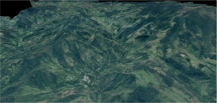
- The generation of orthophotos in some of the most remote and strategic regions of the country, such as the Amazon, Guaviare, and Vaupés.
- The development of LiDAR surveys and digital terrain models under extreme geographic conditions, including mountainous regions and high/-/altitude approaches to snow capped peaks.
- The production of cartographic databases for over 400 population centers (sixth category municipalities), helping close information and planning gaps.
Each of these achievements evidences a firm commitment to enhancing Colombia’s capacity for land management, supporting informed decision-making, orderly planning, and the safeguarding of land-related rights. Cuatro Conceptos provides not only data, but also reliability, precision, and a strategic vision for the future of the regions.


Contact us